

Next race
Sunday, 6 December 2026
9:00 am start
Distance
42.195 km / 26.2 mi
Scenic coastal road
Elevation
Rolling · 150 m gain
150 m climbing
Race profile
Overview
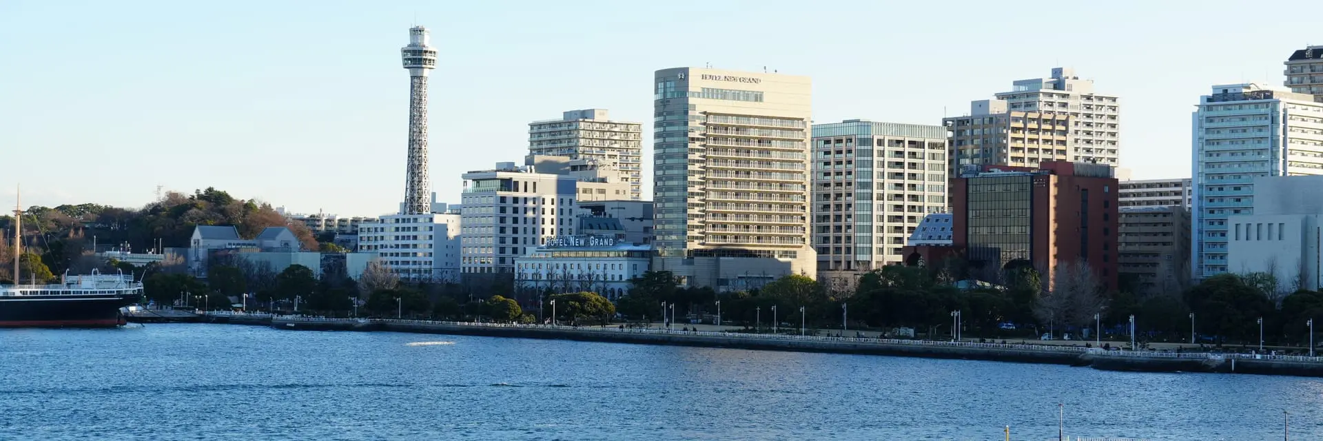
The Shonan International Marathon attracts around 16,000 runners each December along the Sagami Bay coast between Hiratsuka and Kamakura. The course offers Pacific Ocean views, Enoshima Island vistas, and the relaxed beach-town atmosphere of the Shōnan region south of Tokyo. December's cool coastal weather and rolling seaside terrain make it a favourite winter marathon for Kanto-area runners.
Shonan International Marathon is a certified 42.195 km (26.2 mile) marathon — the standard World Athletics marathon distance.
- Typical participants
Approximately 16k finishers
- Weather
Course & terrain
Shonan International Marathon course
Route map and elevation profile for race-week planning.
The Shonan International Marathon is a point-to-point Sagami Bay course from Hiratsuka toward the Shonan coastal zone near Fujisawa, following Route 134 past Enoshima Island views, Shichirigahama beach, and the Miura Peninsula headlands. The flatter coastal sections are the easiest because they stay beside the water, while the moderate headland climbs that keep lifting and dropping along the bay are tougher. Spectators gather at the Hiratsuka start, along Shichirigahama and Enoshima viewpoints, and at the Fujisawa-area finish.
Shonan International Marathon route map
The Shonan International Marathon course is rolling over 42.195 km (26.2 miles). Runners cover 150 metres of climbing and 140 metres of descent, with a net climb of 10 metres from start to finish.
- Elevation
Rolling · 150 m gain — approx. 8 m above sea level
↑ 150 m · ↓ 140 m · net +10 m
Registration
Shonan International Marathon entry requirements
For the Shonan International Marathon, hiratsuka and Fujisawa are on the JR Tokaido Line, roughly one hour from Tokyo Station. Organisers typically provide shuttle buses between finish areas and train stations on race day.
Getting there
Shonan International Marathon travel
Airports closest to Hiratsuka for flight planning and race-week travel.
- Closest airport
Tokyo (HND)
Tokyo Haneda International Airport
48 km / 30 mi
Common questions
Frequently Asked Questions
- What is the Shonan International Marathon elevation profile?
- The Shonan International Marathon has 150 metres of total climbing and 140 metres of descent over 42.195 km (26.2 miles). The course is rolling, with 10 metres of net climb from start to finish.
- Where can I find the Shonan International Marathon route map?
- This page includes a Shonan International Marathon course map showing the full 42.195 km route from start to finish. The course passes Enoshima Island views, Shichirigahama beach, and the Miura Peninsula headlands.
- How long is the Shonan International Marathon?
- The Shonan International Marathon is the standard marathon distance of 42.195 kilometres (26.2 miles), certified to World Athletics rules. Coastal course from Hiratsuka to the Shōnan coastal zone near Fujisawa, following Route 134 along Sagami Bay.
- What time does the Shonan International Marathon start?
- The 2026 Shonan International Marathon starts at 9:00 am local time on Sunday, 6 December 2026. Arrive early for baggage drop and corral access — official race communications confirm any last-minute schedule changes.
- Where does the Shonan International Marathon start and finish?
- The race starts in Hiratsuka on the Sagami Bay coast and finishes in the Fujisawa/Shōnan area. The point-to-point coastal route follows the scenic Route 134 with Pacific views throughout.
- What views can runners expect on the Shonan course?
- Sagami Bay, Enoshima Island, Shichirigahama beach, and Mount Fuji on clear days are highlights. The Shōnan coast is one of Japan's most popular surfing and beach destinations.
- Is the Shonan International Marathon flat?
- No. The coastal road has rolling undulations with climbs over headlands and descents to beach level. It is more challenging than Tokyo's flat city marathons but not mountainous.
- When is the Shonan International Marathon?
- The race is held on the first Sunday of December. Cool coastal breezes are typical at the start.
- How do I get to the Shonan Marathon from Tokyo?
- Hiratsuka and Fujisawa are on the JR Tokaido Line, roughly one hour from Tokyo Station. Organisers typically provide shuttle buses between finish areas and train stations on race day.
Official resources
Shonan International Marathon links
Websites
Social Media
Last updated 11 October 2026. Edition dates and course details are reviewed regularly.
Close to this race
Nearby Marathons
Other races closest to Hiratsuka.


FujikawaguchikoYamanashiJapan· 62 km away
Mt Fuji Marathon
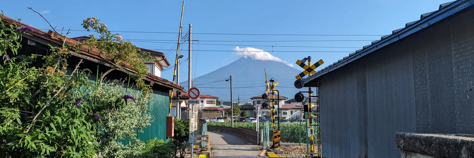
The Mt Fuji Marathon draws approximately 2,500 finishers each November around the Fuji Five Lakes region at the base of Japan's iconic volcano. The course passes Lake Kawaguchi, the Fuji Subaru Line approach, and lakeside roads with Mount Fuji views on clear autumn days. November's crisp highland weather and the sacred mountain backdrop make it Japan's most visually stunning road marathon.
Next race: Sunday, 22 November 2026
Planning guides
Related guides
Practical guides to help you plan, train for, and run this race.

Marathon Course Profiles Explained
What flat, rolling, and hilly really mean — and how to read elevation gain, net change, and altitude on a marathon course.

Marathon Weather: What to Expect
How temperature, humidity, wind, and rain affect marathon performance — and how to use typical race-day weather when choosing a start line.

How to Choose a Marathon
Match a race to your goals — personal bests, sightseeing, atmosphere, or a major milestone — using course data and realistic expectations.